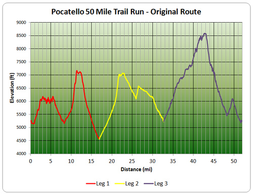
The official course for the Pocatello 50 is out. The full course is 52.3 miles long with 12,600'of vertical gain and 12,600' of vertical loss. The lowest point is 4,500' and the highest point is over 8,500' in elevation. There are two climbs where you ascend over 1,200' per mile, sounds like fun. Below are the course map and profile. The 50+ miler runs all three legs and if you got to pocatello50.com/course-info/ you can find a link to view the course with google earth so you can the course in 3D. I'm looking forward to the challenge, just 3 months left till race day.


My legs and lungs hurt just viewing this stuff. There is wisdom in getting old. I will hike it some day (ok over several days). Your awesome.
ReplyDeleteMine do too, but I know I can do it. just not sure on how fast yet.
Delete